Land at Lergiechoniebeg
Barbreck, Lochgilphead, Argyll & Bute, PA31 8QPOffers Over £185,000
123.11 acres
- A productive area of land
- Situated in a private location with spectacular views over the surrounding countryside
- House ruins may offer some development potential, subject to obtaining the necessary consents
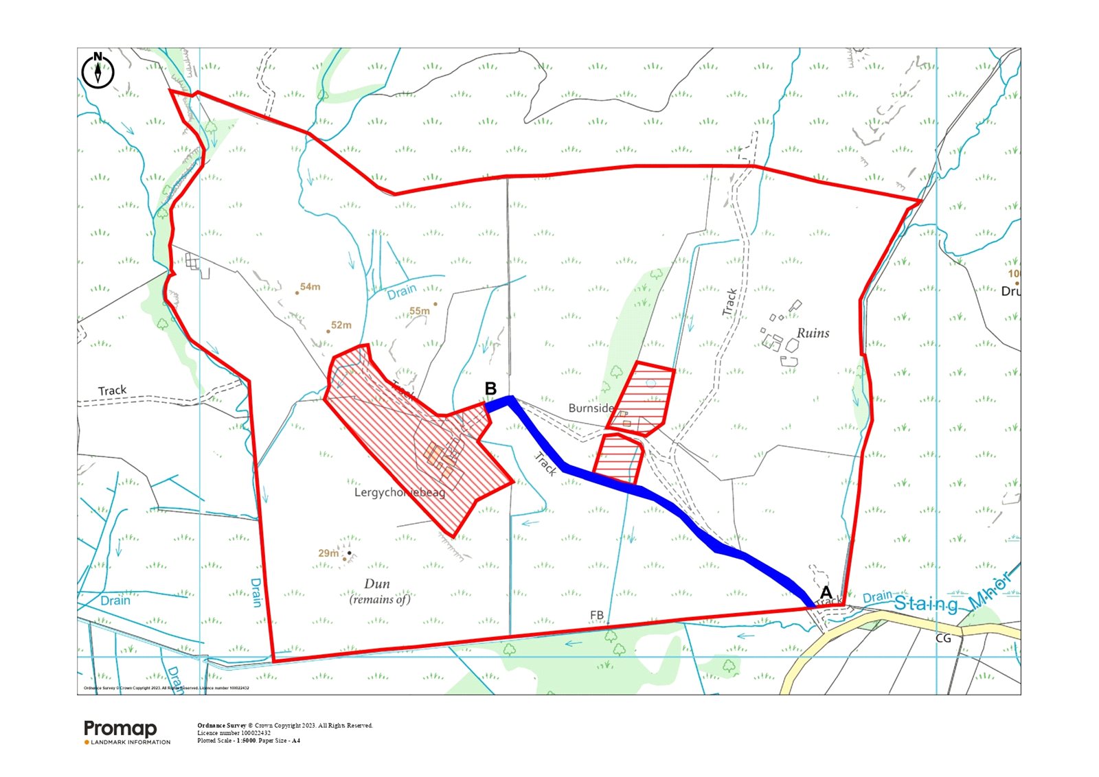
- About 49.82 Ha (123.11 Acres) in total
- For Sale as a Whole
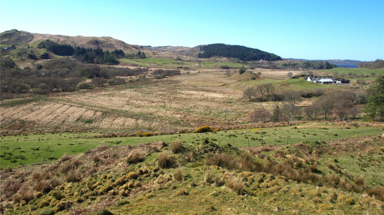
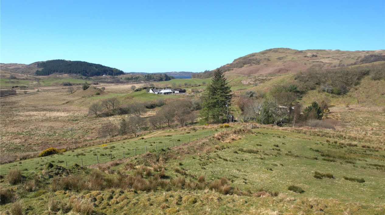
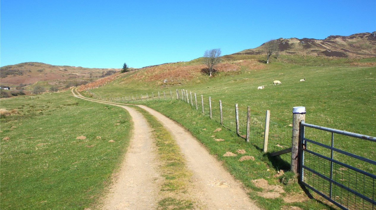
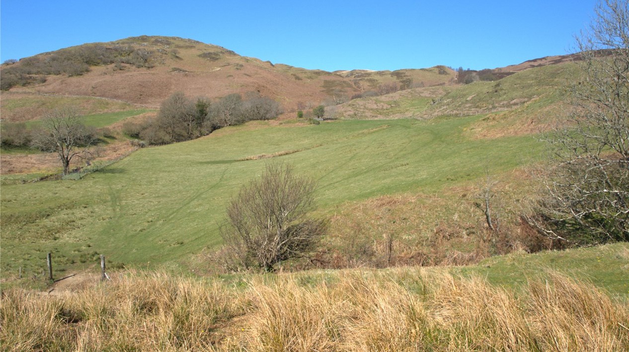
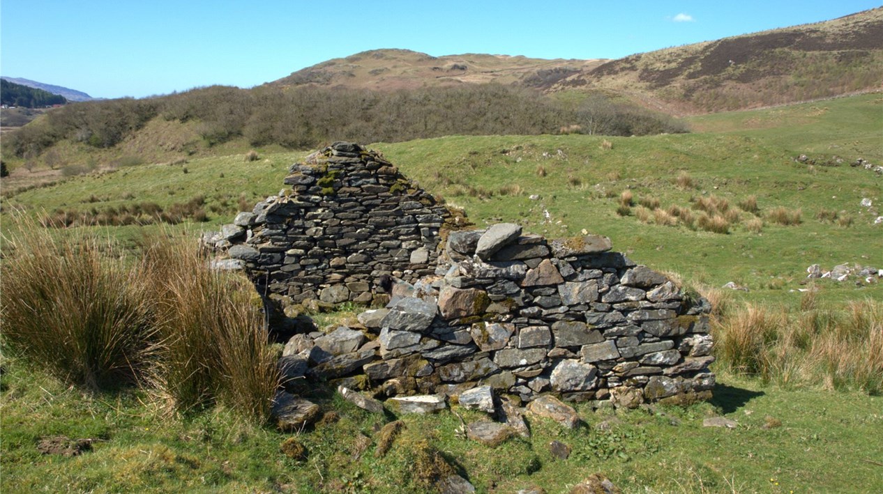
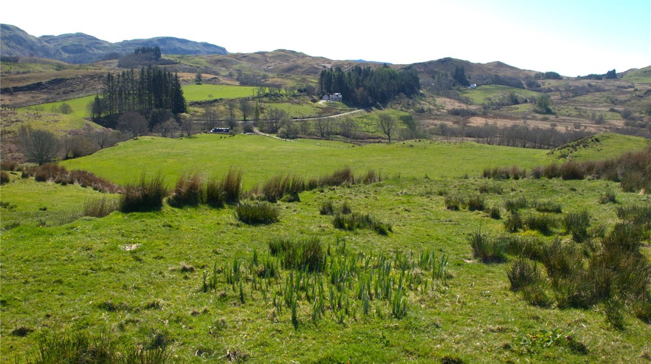
SITUATIONThe Land at Lergiechoniebeg forms an attractive opportunity and is situated approximately three miles to the north east of the small village of Ardfern, and close to the villages of Kilmelford and Craobh Haven. Excellent local services and amenities are on hand in Lochgilphead, around 16 miles to the south. These include shops, bars, hotels, a joint campus with primary and secondary school, swimming pool and a small hospital. Oban is only 25 miles to the north and has a wider range of shops and professional services as well as a railway station, ferry terminal and an airport at nearby North Connel.Argyll is a county offering a wide range of recreational pursuits. The area is a popular field sports destination with a number of estates in the vicinity offering driven and walked up game shooting. It is also a region popular with hill walkers and cyclists with a variety of tracks to suit all levels of fitness. The land is located in an area renowned for the high quality of its stock and timber produced from the surrounding forests. The area is well catered for by a range of agricultural suppliers and outlets including the renowned market at the Oban Agricultural Centre, which offers a first class outlet for livestock.DESCRIPTIONThe subjects form an attractive block of south facing permanent pasture and rough grazing land extending to approximately 49.82 Ha (123.11 Acres). The majority of the land has been classified as Grade 5.2 by The James Hutton Institute, with a small area of Grade 5.3. The land is accessed directly from a private farm track that leads from the unclassified road which then continues through the property, providing good access to most fields.The land rises from 10m above sea level to 63m with the poorer rough grazing located towards the southern, flatter section of the property with the sloping permanent pasture forming the northern part. The remains of several ruined houses are located towards the north eastern section of the subjects, which may offer some development potential, subject to obtaining all the necessary consents.The Seller intends to retain the existing farmhouse, buildings and a small area of grazing ground, as shown on the sale plan. Some of the boundaries between this area and the subjects of sale are unfenced however are marked on the ground. Further details are available from the Selling Agents. The Seller also intends to retain ownership of the access road to the house and buildings, between points A to B on the sale plan. Rights of servitude will be granted to the purchaser across this road.The Seller will also retain all rights to the private water supply currently in use.