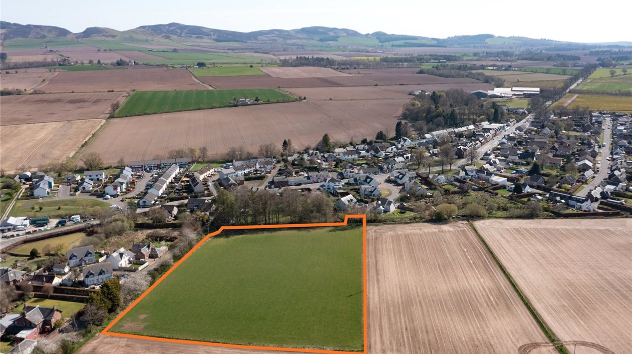
Land North Of Cameron Walk
Burrelton, Blairgowrie, PH13 9NNOffers Over £350,000
3.31 acres
- LOCATION
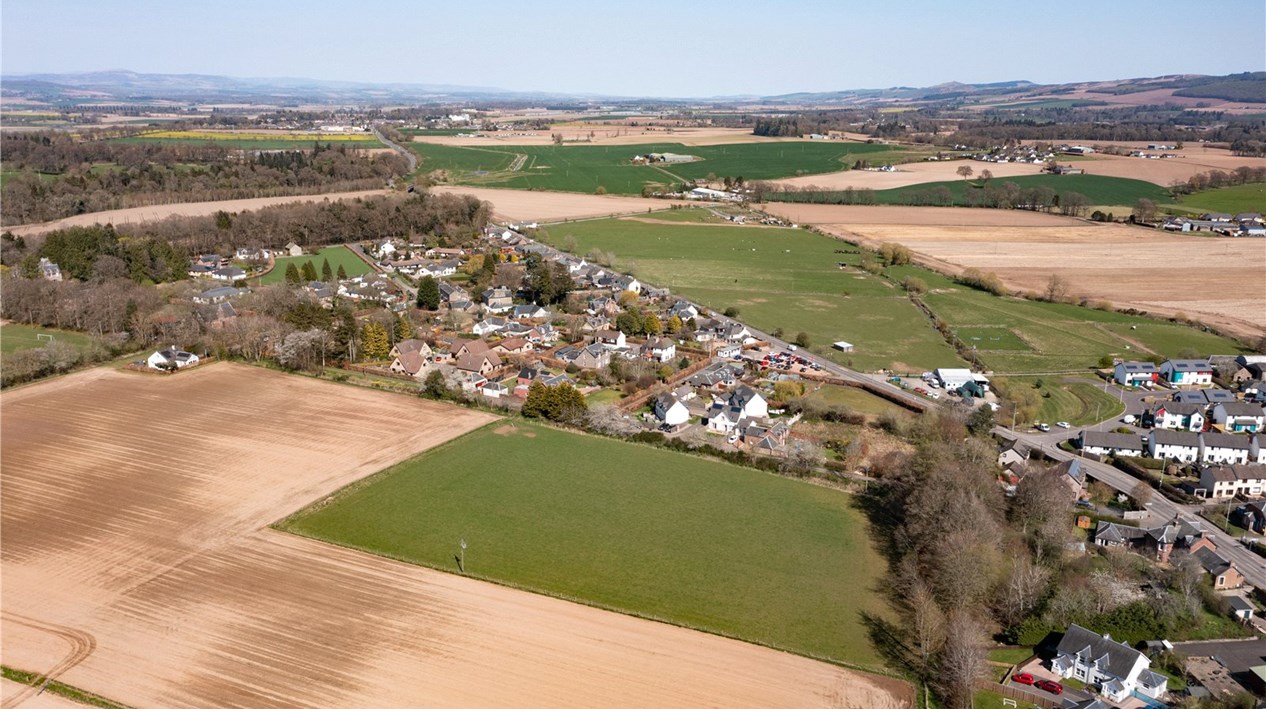
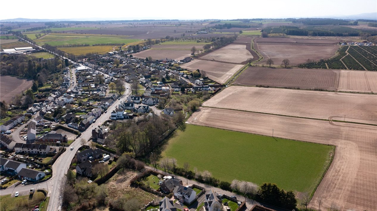
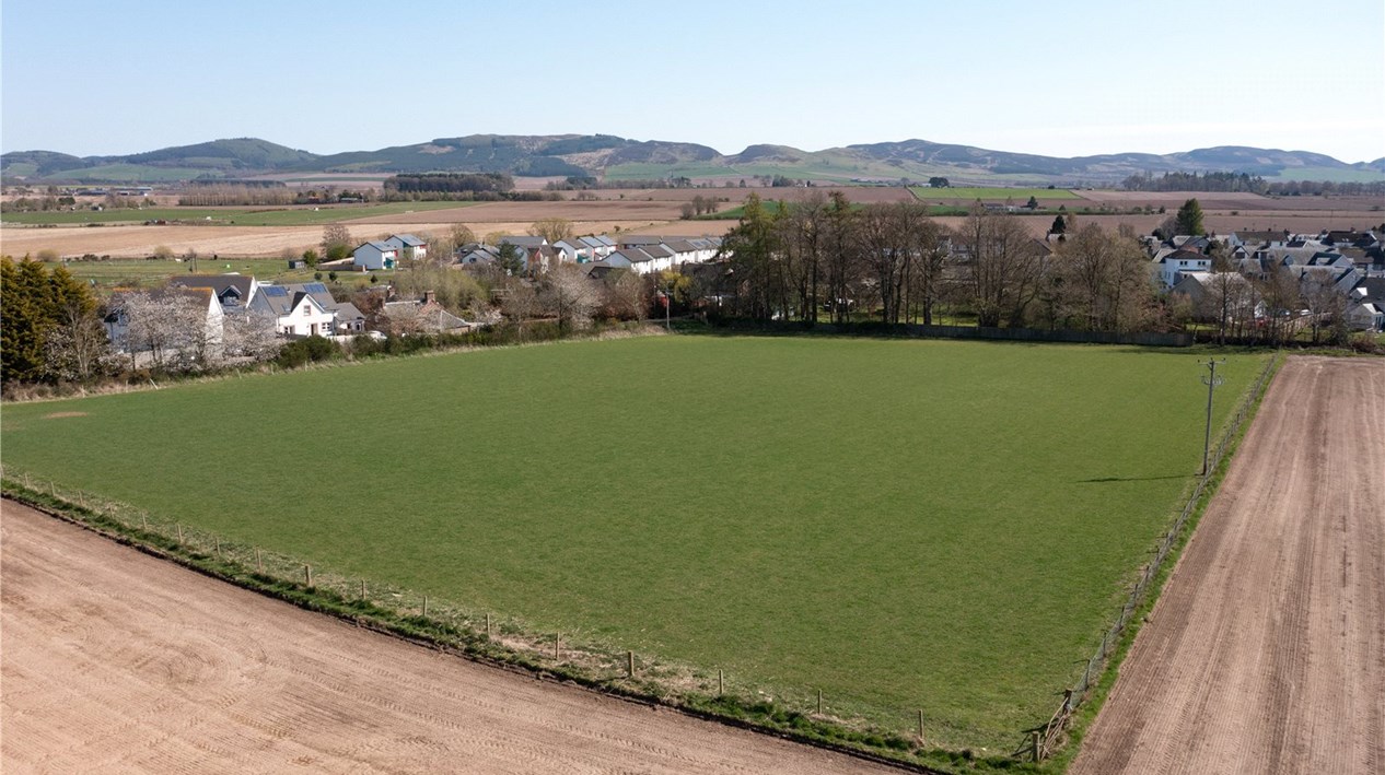
- The land north of Cameron Walk extends to approximately 3.31 acres (1.33 hectares) and is located on the northern edge of the village of Burrelton and enjoys an attractive position with excellent views over the surrounding countryside. Burrelton enjoys a range of amenities including a village shop with post office, butcher and pub. A further range of services are available in Coupar Angus a short distance to the north east. The City of Perth lies approximately 11 miles to the south west and provides all the services expected of a major centre.
- DESCRIPTION
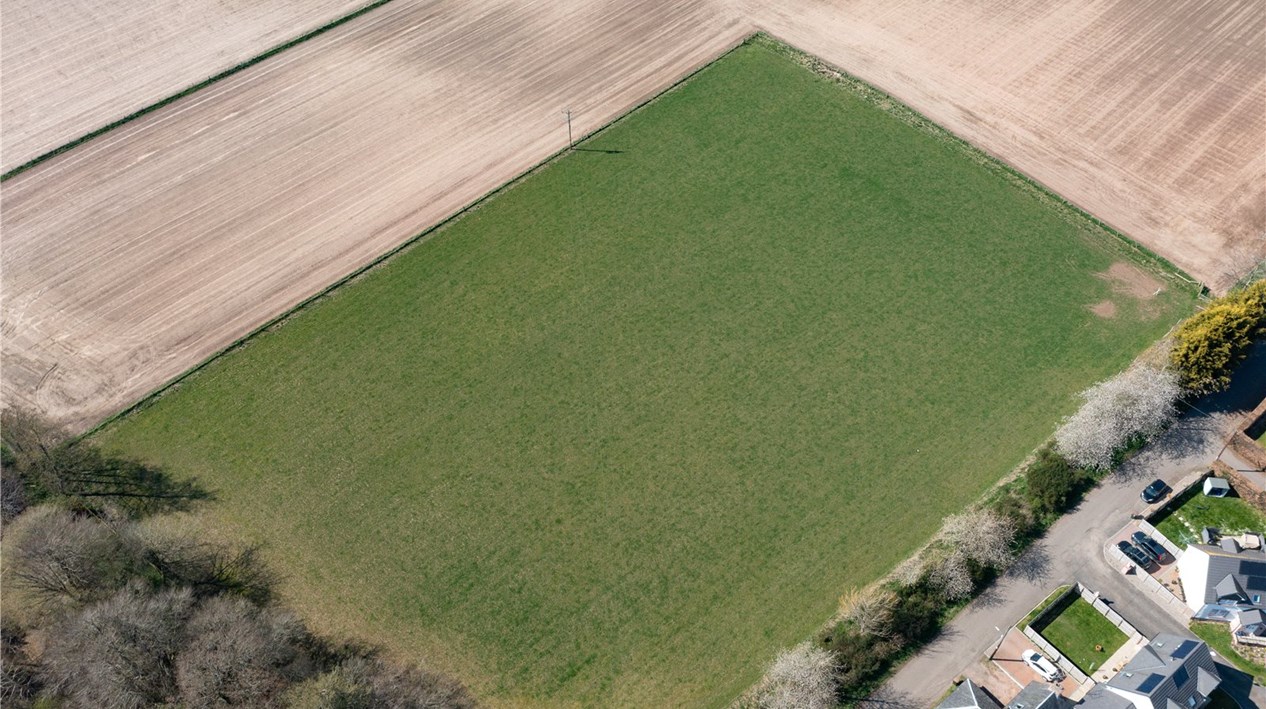
- The land is generally level and down to grass and will benefit from direct access off Cameron Walk to the south. The site is bounded to the south and east by residential properties and agricultural land to the north and west.
- The grass field within the property is at present subject to an Agricultural Lease. Formal notice to terminate this Lease has been given, on the basis that planning permission has been granted for development. The Notice will expire at Martinmas [28 November] 2024 at which time vacant possession is anticipated, and entry will not be given prior to the termination of that lease. Any contract for sale will be conditional on the termination of the Lease.
- PLANNING
- The land is zoned in the Perth and Kinross Local Development Plan for residential use with an indicative capacity of 16 to 26 units under ref: H17. Furthermore, the site benefits from planning permission in principle for residential development granted by Perth and Kinross Council on 8th December 2022, under ref: 22/00951/IPL.
- The site will be accessed via Cameron Walk and all necessary rights of access and ownership have been secured.
- A transport access assessment has been carried out and approved for the proposed access via Cameron Walk.
- A flood risk assessment has been carried out and identified that a small section of the southern part of the site may be at risk of flooding. Accordingly any build development should be located on the central and northern sections of the site.
- It should be noted that a right of access in favour of the neighbouring landowner exists between to field gates in the north east and north west corners of the site.
- TECHNICAL INFORMATION AND DATA ROOM
- Plans showing the location of mains infrastructure, the site plan, transport assessment and flood risk assessment are available in the data room, which may assist parties with their appraisal of the site.
- The pertinent information is available via an online data room – please contact Galbraith for access.
- Any further planning enquiries can be directed to Perth and Kinross Council: 01738 475 000
- METHOD OF SALE
- Our clients are seeking offers in excess of £350,000 for their freehold interest in the land.
- A deposit of £35,000 will be paid on the conclusion of missives, the deposit will be non-refundable but deductible from the purchase price.
- Interested parties will be notified of a closing date and requested to submit a heads of terms offer. Galbraith will issue the required form of offer to interested parties on notification of the closing date. The form of offer will include the minimum information required and timescales.
- We recommend that interested parties note their interest in the site in order to be kept informed of any closing date and to receive any additional pertinent information.
- LEGAL COSTS
- Each party will be responsible for bearing their own legal costs. The purchaser/s will be responsible for LBTT, registration dues incurred in connection with the transaction.
- VIEWING AND FURTHER INFORMATION
- The site is open and may be viewed without prior appointment, however, parties are asked to give due courtesy to owners of property and to give due consideration to bio security risks and welfare of any livestock present on the subjects.
