Productive block of grazing ground for sale within the Battle of Sherrifmuir battlefield
Sales News 13 September 2023
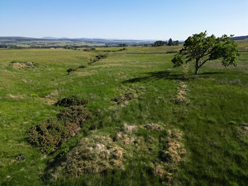
A Productive block of grazing ground near Stirling in Central Scotland is being marketed through leading property consultants Galbraith.

Land At Upper Whiteston Farm is located in a rural yet highlight accessible area to the south of the A9, approximately four miles to the east of the town of Dunblane and approximately eight miles north of Stirling.
The property is surrounded by land which is mainly used for agricultural and forestry purposes and falls within the Battle of Sheriffmuir Battlefield. The Battle of Sheriffmuir was an engagement in 1715 at the height of the Jacobite rising in England and Scotland.
The land lies in an elevated position, which extends to 63.93 Ha (157.97 Acres) and has been classified by the James Hutton Institute as a mixture of Grade 4.1, Grade 4.2and a small area of Grade 3.2. The land rises from approximately 170m to 200m above sea level with a slight north westerly aspect.
Alistair Christie, handling the sale for Galbraith said: “The Land at Upper Whiteston Farm is all rough grazing and has been used for the grazing of livestock. Interestingly, the land is also classified as F3 by the Land Capability for Forestry by the James Hutton Institute indicating that the land has good flexibility for the growth and management of tree crops which may interest buyers keen to explore afforestation opportunities. The land has been graded very suitable for Sitka Spruce and suitable for Broadleaves planting.”
The property is surrounded by land which is mainly used for agricultural and forestry purposes.
Land At Upper Whiteston Farm, Dunblane, Stirlingshire is for sale through Galbraith at offers over £485,000.